
LIVE ON THE STRATEGIC ROAD NETWORK
From field survey to infrastructure intelligence.
Arbrium brings asset data, field surveys, evidence, workflows and reporting together in one geospatial platform — built for managing vegetation at scale.
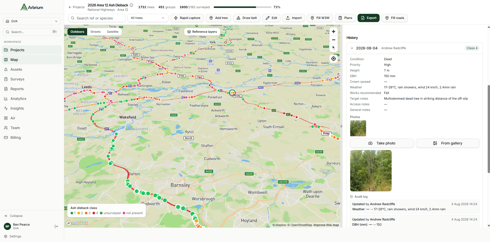
Built alongside industry.
Supporting live operational surveys on live infrastructure programmes.
Designed with practising surveyors and asset managers.
Built around real GIS workflows, not a generic form builder.
THE PROBLEM
Vegetation management is still run on spreadsheets.
Not because the teams are behind — because nothing existed that understood assets, geography, evidence and professional sign-off at the same time.
Arbrium was built inside a live national infrastructure vegetation programme, alongside the surveyors doing the work.
01
Vegetation risk is a national liability, not a project.
Millions of assets across live infrastructure networks need managing at once. Asset owners are expected to evidence what was inspected, when, by whom, and what was done about it — across whole networks, every year.
Arbrium holds every asset, every inspection and every photograph in one auditable record.
02
The data lives in spreadsheets and inboxes.
Field notes are typed up twice, photographs sit on phones, GIS layers drift out of step with the survey sheet, and each contractor returns a different format.
One GIS-native database, one template per programme, one export that matches the client's spatial portal.
03
Nobody can prove the history of a single asset.
When something fails or a claim lands, the question is always the same: what did you know, and when? Reconstructing that from archived spreadsheets takes days.
Open the asset, see every survey since import — condition, class, works and photographs, in sequence.
INDUSTRIES
One platform.
Every vegetation estate.
Arbrium is configured per estate — inspection templates, condition scoring and export formats adapt to the standard your client audits against, without forking the system.
1,685
Assets under management
6
Estate types supported
100%
Evidence-backed records
Highways
LIVE DEPLOYMENTAsh dieback programmes, verge and soft estate inspections, carriageway-side risk and works scheduling across network areas.
02
Utilities
· Powerline corridors
Clearance surveys and encroachment tracking along overhead line routes.
03
Rail
· Railside vegetation
Lineside risk assessment, leaf-fall planning and boundary tree condition.
04
Local Government
· Public realm assets
Street and park asset registers with defensible inspection histories.
05
Forestry
· Woodland management
Compartment mapping, woodland polygons and long-term stand records.
06
Environmental Consultancy
· Professional survey delivery
Multi-client delivery with per-project teams, templates and export formats.
PLATFORM
One platform. Every inspection. Every asset. Every year.
PLAN
GIS mapping, project setup and asset registers, ready before boots hit the ground.
INSPECT
Offline-first mobile surveys with structured photography and evidence capture.
MANAGE
Reporting, condition history and lifecycle analytics across every asset you hold.
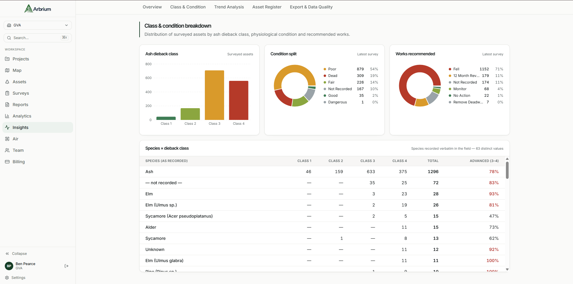
ASSET INTELLIGENCE
Every asset, remembered.
Condition change tracked visit after visit, year after year. Permanent, defensible asset intelligence that no spreadsheet can replicate.
ASSET RECORD
Asset A-1620 · M606 corridor
5 inspections
2022
Class 1
Baseline import · Monitor
2023
Class 1
Annual inspection · Monitor
2024
Class 2
Annual inspection · Monitor
2025
Class 2
Annual inspection · Reinspect 12m
2026
Class 3
Operational survey · Priority works
Deterioration trend detected across 4 years — every note, photograph and work order preserved against the asset.
WHY ARBRIUM
The outcome, not just the software.
70%
Less time spent on manual data entry and report formatting
100%
Of asset history retained — searchable, permanent, defensible
3×
Faster turnaround from field survey to client-ready report
0
Spreadsheets required to manage an inspection programme
Fragmented and unproven.
Condition data scattered across spreadsheets and inboxes
No consistent record of what was inspected, when, or by whom
Reports built manually, one client at a time
Asset history lost when staff or contractors change
Unified and defensible.
Every survey, photo and note attached permanently to its asset
A single, auditable source of truth across the programme
Reports and exports generated in minutes, not days
Institutional knowledge that survives staff and contractor turnover
WORKFLOW
From field survey to finished report.
01
Plan the mission
Select assets directly from the map and generate an inspection route in seconds.
02
Capture in the field
Surveyors record condition data offline; Arbrium Air captures consistent imagery.
03
Review the evidence
AI links imagery to each asset and drafts observations for expert review.
04
Approve the survey
A qualified surveyor checks, amends and signs off every assessment.
05
Deliver the report
Export client-ready reports, GIS layers and evidence in the format they need.
REPORTING & EXPORT
Reports built for the client in front of you.
Generate a client-facing summary for a highways authority, or a full internal record with works history for your own team — the underlying survey data stays the same, only the audience changes.
M606 Corridor — Condition Report
CLIENT VIEWASSET
TYPE
CLASS
RECOMMENDATION
A-1620
Tree
Class 2
Monitor
A-1621
Tree
Class 1
Monitor
A-1633
Hedge
Class 3
Priority works
A-1640
Verge
Class 2
Reinspect 12m
CASE STUDY — STRATEGIC ROAD NETWORK
“We went from a filing cabinet of vegetation surveys to a single system that tells us exactly what condition every asset on the corridor is in — and proves it.”
Asset Manager, Regional Highways Programme
12,400+
Assets surveyed to date
40 mi
Corridor under continuous monitoring
4 yrs
Of continuous condition history

Autonomous evidence capture, built in.
Plan a mission from the map, launch a drone under a qualified pilot, and let Arbrium Air capture consistent imagery for every asset — surveyors stay in full control of the final assessment.
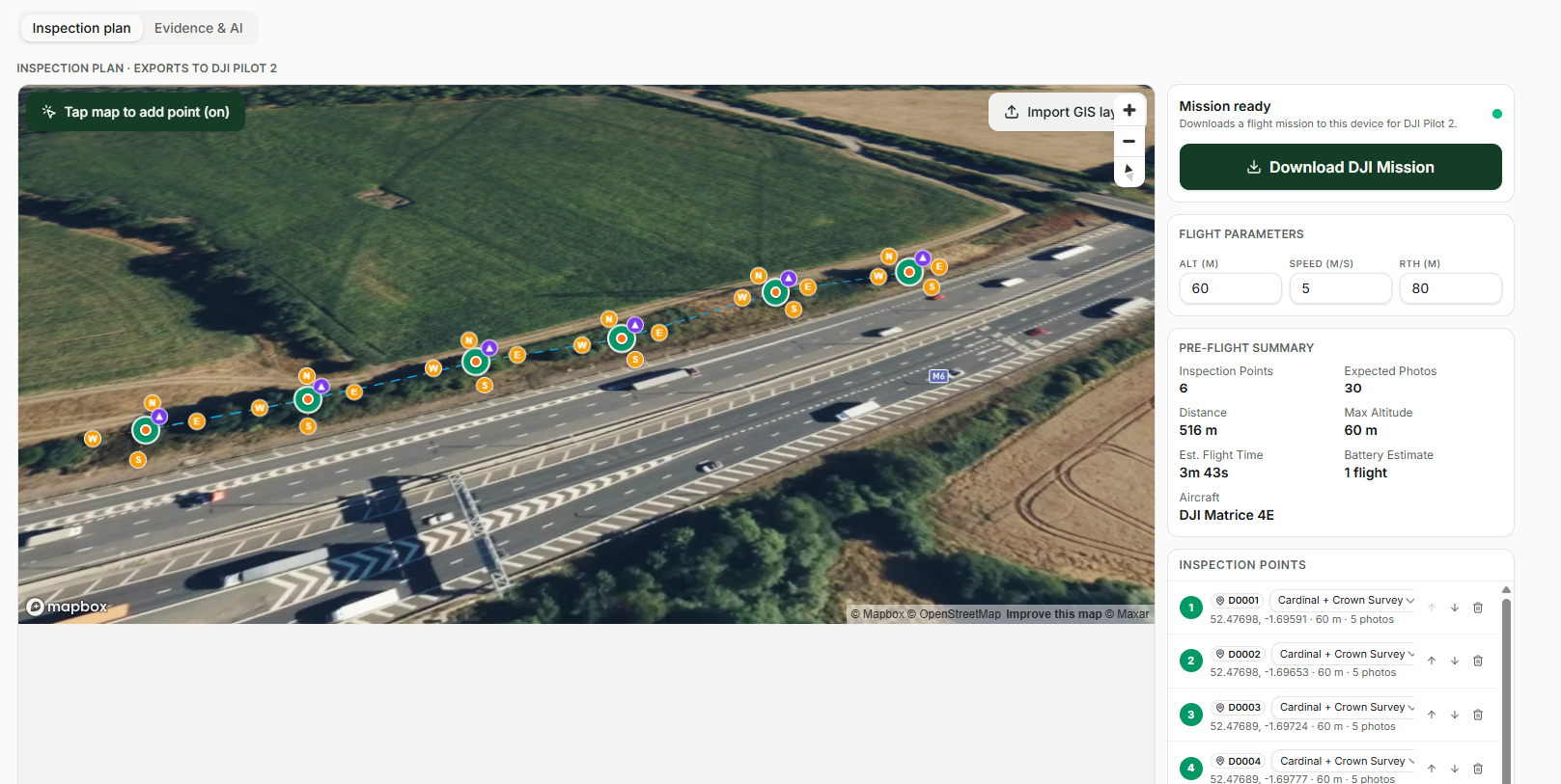
Mission planning from the map
Consistent drone-captured imagery
AI-assisted evidence review
IN BETA — SELECTED CUSTOMERS
ROADMAP
Built for highways. Expanding beyond it.
Vegetation Management
Full survey, evidence and reporting workflow — live today on the strategic road network.
Arbrium Air
Autonomous drone-assisted evidence capture, in beta with selected customers.
Utilities & Rail
Extending the same asset intelligence platform to corridors beyond the road network.
Predictive Risk Modelling
Forecasting condition and prioritising works before problems become liabilities.
BUILT FOR AUTHORITIES & ENTERPRISE
Ready for how infrastructure teams actually work.
Data Ownership
Your survey data, evidence and history stay yours — export it in full, at any time.
Role-Based Access
Control exactly who can see, edit or export each project and asset record.
Audit-Ready History
Every observation and export is timestamped and attributable, ready for scrutiny.
Dedicated Onboarding
A named team to help you migrate existing data and train your surveyors.